Sula 5 Coastal Unmanned Surface Vessel
Sula 5 coastal unmanned surface vessel, 5 m long, for harbours and near-shore sea. Carries a parametric sub-bottom profiler, side-scan and USBL tracking.
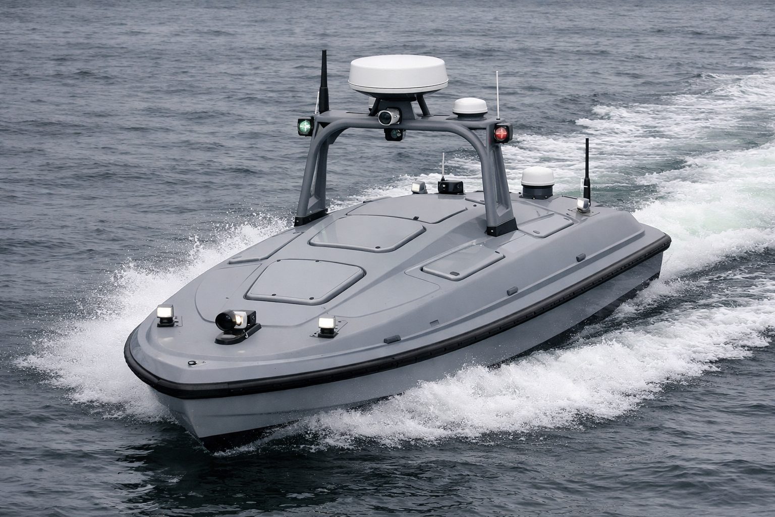
Sula 5 is a 4.9 m unmanned surface vessel, battery-electric or with a 40 hp outboard, for harbour and near-shore sea work. It is the smallest of our platforms we configure for a towed production magnetometer such as the Geometrics G-882, and it carries a parametric sub-bottom profiler such as the Innomar SES-2000, a towed side-scan on a reel, USBL tracking and Starlink. We configure each boat to order, with RTK GNSS position and dual-antenna heading as standard.
Platform specification
Sula 5 comes in an electric and a fuel version.
| Sula 5 | |
|---|---|
| Length | 4.90 m |
| Beam | 1.95 m |
| Draft | 56 cm |
| Mass | 350 kg empty |
| Payload | Up to 600 kg |
| Hull | Polyethylene (PE) and other materials |
| Propulsion | Electric version: two 5.5 kW electric motors. Fuel version: 40 hp outboard |
| Endurance | 3 h (electric); 8 h (fuel) |
| Maximum speed | 12 km/h (6.5 kn), electric; 45 km/h (24.3 kn), fuel |
| Comms | 4G, 5G and satellite |
| Water | Lakes, rivers, reservoirs, harbour waters and near-shore sea areas |
Payloads Sula 5 takes
Everything Sula 2 takes also fits. Sula 5 adds:
| Payload | Example models | Mount | Note |
|---|---|---|---|
| Towed magnetometer or gradiometer | Geometrics G-882, G-882 TVG; Marine Magnetics SeaSPY2, Explorer, SeaQuest2; SENSYS MX3D | Towed | One tow. A G-882 fish weighs 18 kg and draws 12–16 W running. Layback keeps the sensor clear of the hull’s magnetic signature. |
| Parametric sub-bottom profiler | Innomar SES-2000 compact, SES-2000 standard | Hull | Needs a survey INS. The SES-2000 compact has a transducer of about 22 kg with 20 m of cable and a topside of about 15 kg, and draws 50 W typical, 100 W at most. |
| Side-scan sonar, towfish with reel and depressor | EdgeTech 4125i; JW Fishers 450/900 CHIRP with CMS-2 reel and DDW-1 depressor | Towed | A heavier towfish needs a tow point and recovery gear on a larger hull. |
| USBL for a towed body | Blueprint Subsea SeaTrac X150 with X010 beacon; Sonardyne Micro-Ranger 2 | Hull | Positions the tow. Layback from a winch cable counter is the cross-check. |
| Starlink | Starlink Flat High Performance | Mast | Satellite broadband back to shore. |
Where Sula 5 stops. It runs one tow at a time. Step up to Sula 8 for the full UXO system: a gradiometer and a side-scan as two tows, a sub-bottom profiler with survey INS, USBL and a powered winch, with Iridium Certus satcom as a backup to Starlink. Step down to Sula 2 for multibeam, light side-scan and camera work from a hull that fits in a van or on a small trailer.
Applications
- Offshore-wind UXO magnetometer survey with a single tow, in near-shore water. Sula 5 is the smallest of our platforms we configure for a G-882 tow.
- Cable-route survey. Parametric sub-bottom profiling and towed side-scan along cable routes near shore.
- Coastal multibeam in harbours and near-shore water, for up to 8 h on the fuel version.
- Towed side-scan survey with a towfish on a reel and depressor, tracked by USBL.
- Port security and harbour inspection with a sensor mast, AIS and Starlink back to shore.
Sula 5 works on lakes, rivers and reservoirs, in harbours and in near-shore sea areas. Endurance depends on the version: 3 h for the electric version, 8 h for the fuel version.
Navigation
Standard: RTK GNSS position with dual-antenna heading. With survey payloads aboard, one survey GNSS/INS is the reference for every sensor, with PPS time sync. The RTK correction feed comes from a base station on site or from network corrections over mobile data.
Option: anti-jam navigation. Pro is the natural tier for Sula 5, and the Base set also fits.
- Pro: a multi-element CRPA with null-steering, a tactical-grade fibre-optic-gyro (FOG) inertial unit, and a flush-mount surface-vessel Doppler velocity log (DVL) in a sea valve or bell housing.
- Base: a filtered anti-jam antenna, a compact inertial unit of industrial (MEMS) or lower tactical grade, and a compact DVL.
With either set, spoofing detection with automatic source switching is configured and integrated per boat, and integration with the autopilot is available. DVL bottom-lock needs the seabed within range, which means shallow and coastal water; in deep water the DVL falls back to water-track, and drift then depends on the inertial unit’s grade. More on the tiers: GNSS-denied USV navigation.
Integration and support
| Integration | Payload fitted, wired and calibrated on the hull, with sensor offsets and parameters set and the RTK correction feed configured. Autopilot integration is available. |
| Delivery | Commissioning on your water, operator training, and support from our UK and EU teams. |
| Ordering | Configured to order, quoted per boat. |
Questions and answers
What is the smallest unmanned surface vessel that tows a G-882 magnetometer?
Of our platforms, Sula 5 is the one we configure for a G-882 tow. The smallest hull with a record of towing Geometrics G-882 magnetometers on offshore-wind UXO survey is 4.5 m long. A G-882 fish weighs 18 kg, and the tow needs force and enough layback to keep the sensor clear of the hull’s magnetic signature.
Can a coastal USV run a full UXO survey system?
It runs one tow. The full system tows a gradiometer and a side-scan together and adds a sub-bottom profiler with survey INS, USBL and a powered winch. That needs a second tow point and an offshore hull: Sula 8.
Can a coastal USV carry a parametric sub-bottom profiler?
Yes, comfortably. An Innomar SES-2000 compact has a transducer of about 22 kg with 20 m of cable and a topside of about 15 kg, draws 50 W typical and 100 W at most, and needs a survey INS. Sula 5 takes up to 600 kg of payload.
How long can a coastal USV stay at sea?
Sula 5 runs 3 h in its electric version and 8 h in its fuel version.
Discuss a USV
Tell us about the payload, the water you work on and how long each mission runs.
