Hydrographic Survey USV
Unmanned surface vessel for hydrographic survey: single-beam package on Sula 1, multibeam tier on Sula 3, side-scan option. Configured to order.
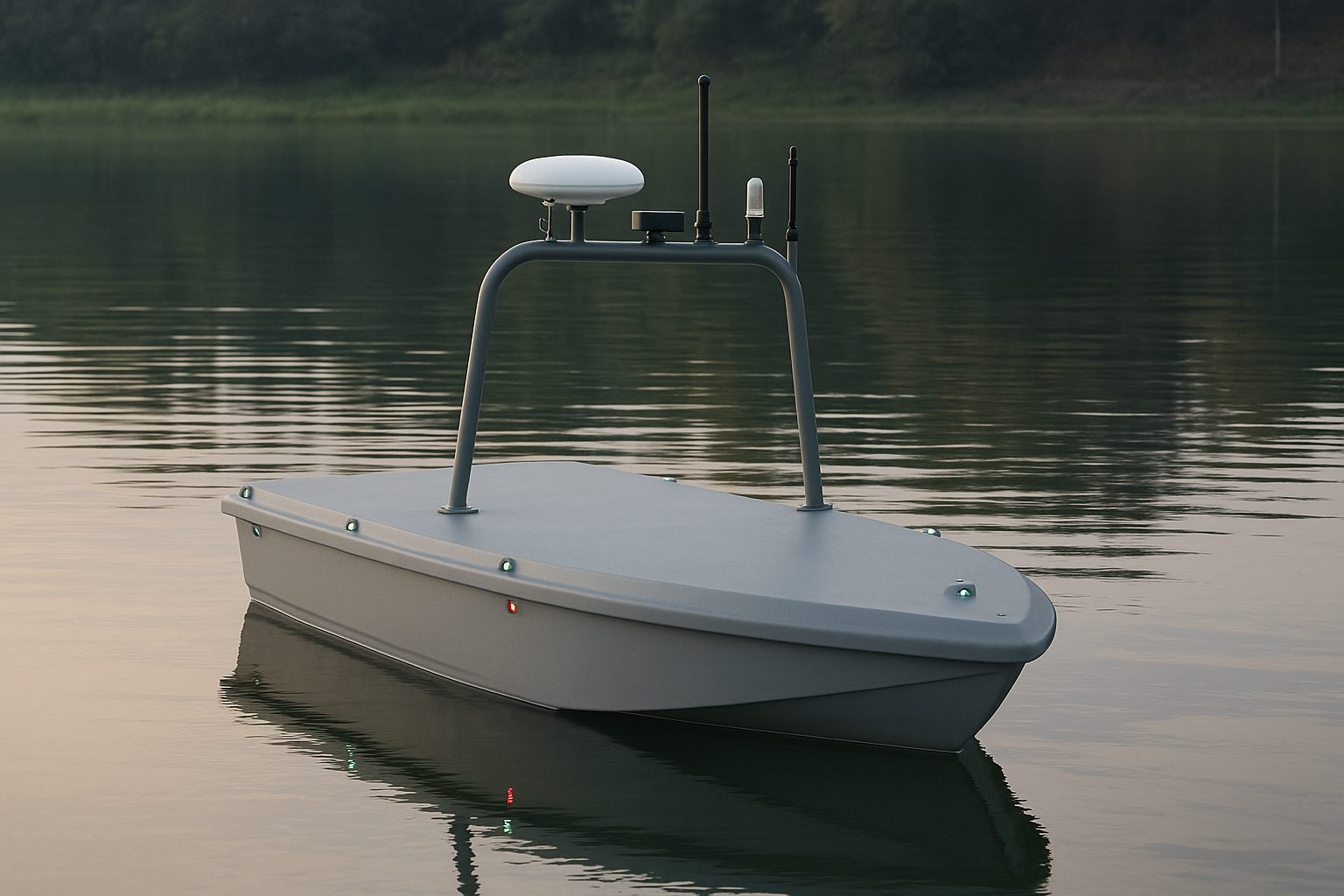
We supply hydrographic survey packages on our unmanned surface vessels (USVs). The standard package is single-beam survey on Sula 1, our portable platform: RTK position and dual-antenna heading, a dual-frequency single-beam echo sounder and a sound-velocity probe, with survey software that plans lines, logs each sounding with its position and produces bathymetric output. A multibeam tier on Sula 3, our compact platform, is available to order, and side-scan is an option on both. Each package is configured for your water and the standard you survey to. You hold the qualifications and run the survey. We don’t operate surveys.
Survey standard: IHO S-44
Most hydrographic work is specified against IHO S-44, Standards for Hydrographic Surveys, or against a client specification built on it. These are the minimum bathymetry figures in Edition 6.1.0 (October 2022). All uncertainties are at 95% confidence.
| Order | Horizontal uncertainty | Vertical uncertainty (a, b) | Feature search | Bathymetric coverage |
|---|---|---|---|---|
| Exclusive | 1 m | 0.15 m, 0.0075 | 200%: cubic features over 0.5 m | 200% |
| Special | 2 m | 0.25 m, 0.0075 | 100%: cubic features over 1 m | 100% |
| 1a | 5 m + 5% of depth | 0.5 m, 0.013 | 100%: cubic features over 2 m to 40 m depth | up to 100% |
| 1b | 5 m + 5% of depth | 0.5 m, 0.013 | Recommended, not required | 5% |
| 2 | 20 m + 10% of depth | 1.0 m, 0.023 | Recommended, not required | 5% |
The vertical limit at a depth d is the square root of a squared plus (b times d) squared. At 10 m depth that is about 0.26 m for Special Order and about 0.52 m for Orders 1a and 1b.
What follows from the table:
- Single-beam measures along the track only. Orders that require a 100% feature search, which are Exclusive, Special and 1a, call for swath coverage, so they are multibeam work. The single-beam package suits work where the standard asks for sounding lines and does not require full coverage: Order 1b, Order 2 and the many client specifications that ask for sections, volumes or routine depth checks.
- The sounder is one term in the vertical budget. Sound velocity, draught and offsets, motion and water level add to it, and the order is shown by the survey’s own checks on your water.
- We don’t state an order for a configuration. Your client’s specification may differ from S-44. Tell us the figure it sets and we configure against it.
Single-beam survey package on Sula 1
Sula 1 carries the package on a hull one person lifts into a car. The Sula 1 page has the platform figures. This section covers the survey system.
| Requirement | What the package carries |
|---|---|
| Depth range | Single-beam survey sounders in this class are rated from 0.15 to 0.3 m at the shallow end up to 100 to 200 m at the deep end, depending on the unit. The rated range of the sounder in your configuration is stated in the configuration. Sula 1 works in sheltered water. |
| Depth accuracy | Typical of the class: ±1 cm plus 0.1% of depth, as rated for survey sounders of this class. The rating of the unit in your configuration is confirmed per quote. It covers the sounder’s own contribution to the uncertainty. Sound velocity, offsets and water level add to it. |
| Frequency | Dual-frequency. The frequencies and beam angle of the unit in your configuration are stated in the configuration. |
| Positioning | RTK GNSS, centimetre-level, with corrections from a base station on site or from network corrections over mobile data. |
| Heading | Dual-antenna GNSS heading from a survey-grade receiver with light inertial (MEMS) aiding. Heading comes from the satellite geometry of the two antennas and is independent of a magnetic compass. On a 1 m hull the antenna baseline is short, which limits heading precision. |
| Sound velocity | A sound-velocity probe measures the speed of sound in the water column. |
| Motion and heave | No separate motion reference unit in the single-beam package. The multibeam tier adds one. |
| Data output | Depth as NMEA 0183 serial sentences, logged with RTK position, heading and time. |
Frequency choice
If your specification names a frequency or a beam width, tell us and we match it.
Single-beam units we can configure instead, where a project specifies one, are listed separately from the package sounder. The Bathylogger BL200 is one. Seafloor HydroLite and HydroLite Plus are also available as named options; their frequency, beam and output are confirmed per quote.
| Option | Frequency | Beam | Output |
|---|---|---|---|
| Bathylogger BL200 | 200 kHz | 9° | NMEA depth |
Sound-velocity correction
Echo-sounder depth is time multiplied by sound speed, so an error in sound speed becomes a depth error. The probe measures the speed of sound through the water column. The correction is applied in processing, using a profile taken for each survey and repeated as the water changes. Sound velocity is optional for single-beam and a required input for multibeam, where it also corrects refraction.
Positioning, offsets and heading
Every sounding is logged with an RTK position, a heading and a time. The distance from the GNSS antennas to the transducer, the lever arm, is set for the boat at fitting, along with the other sensor offsets. RTK position error is small against the horizontal limits in the S-44 table. The larger terms are the lever arm, heading and the beam footprint, which grows with depth.
Multibeam tier on Sula 3, available to order
A multibeam echo sounder measures a swath of depths across the track, so neighbouring lines overlap and join into full-bottom coverage. Choose it where the standard asks for a full feature search, and for berths, navigation channels, dredged areas and anything else where the bed between the lines matters. It runs on Sula 3, which carries survey-grade multibeam with its own motion reference. Sula 1 can take a compact integrated head such as the Cerulean Surveyor 240-16 (see the Sula 1 page). The tier adds a separate motion reference and a profiling sound-velocity probe.
| Requirement | What the tier carries |
|---|---|
| Multibeam head | A compact multibeam head chosen per project. The standard compact head is typically rated to about 150 m; the heads listed below are rated deeper. The head and its rating are confirmed per quote. |
| Motion and heave | A motion reference unit or survey INS of the grade multibeam needs, correcting each ping for heave, roll and pitch. |
| Sound velocity | A profiling sound-velocity probe, so each beam is corrected for refraction. We configure Valeport SWiFT and AML Oceanographic units. |
| Positioning and heading | The Sula 1 set: RTK GNSS with dual-antenna heading. The Sula 3 hull gives the antennas a longer baseline. |
Heads we supply and configure:
| Head | Frequency | Swath | Depth |
|---|---|---|---|
| Cerulean Surveyor 240-16 | 240 kHz, 4° by 7° beams | 80° | Rated to 300 m, with a 100 m range. IMU built in. |
| WASSP S3 | 160 kHz, 224 beams | 120° | 1 to 400 m |
If you supply or specify an R2Sonic Sonic 2020-V or a Norbit WBMS, we integrate it on the same terms: mounting, motion reference, sound velocity and offsets. We don’t supply those heads.
A multibeam installation needs a patch test on the water after fitting. It calibrates the head’s alignment against the motion reference, and it is repeated if the head is moved. A head’s rated depth range does not describe the depth at which a survey reaches an S-44 order.
Side-scan option
Side-scan builds an image of the bed. It finds objects, wrecks, debris, pipelines and scour, and it does not give survey-grade depths. It goes alongside the sounder on both platforms, where the payload and the mounts allow. We confirm the fit for each configuration.
| Option | Mount | Frequency | Range per side | Beam |
|---|---|---|---|---|
| Cerulean Omniscan 450 SS | Hull bracket on Sula 1 | 450 kHz | 150 m | 0.5° |
Other options are the DeepVision hull-mount 340/680 on Sula 1, and on Sula 3 the Blueprint Subsea StarFish 990F and the DeepVision DE340/680 as light towfish. We confirm each unit’s frequency, range and beam per quote. Range per side sets the line spacing.
A towed fish sits astern of the boat. On these hulls the fish is on a hand reel with no acoustic tracking, so its position is estimated from layback, from cable out and depth, and target positions carry that layback error. USBL tracking of a tow starts at Sula 5.
Processing chain
Processing is your workflow. These are the steps a survey’s processing covers:
- Acquisition. Each sounding is logged with RTK position, heading and time.
- Corrections. Sound velocity, lever arm and offsets are applied. A multibeam adds the motion reference’s heave, roll and pitch and the refraction correction from the sound-velocity profile. Depths are reduced to your datum with a water level from RTK height or a gauge.
- Cleaning and checking. In processing software, outliers are removed and the lines are checked against cross lines.
- Products. A bathymetric surface and the charts or sections your specification asks for.
We configure acquisition with you, and commissioning on your water covers acquisition set-up. Driver support for the sounder, the heading receiver and the motion reference is checked for each configuration.
Survey deliverables
What your client receives depends on the specification. A bathymetric survey usually contains:
- the soundings or the gridded surface, in your coordinate system and vertical datum, with the survey date and the water level used;
- the corrections applied: sound velocity, offsets and, for multibeam, motion and the patch-test values;
- the checks that show the order achieved, which are cross lines and a comparison against a reference;
- the bathymetric chart or sections;
- a survey report that records the equipment, the calibration and the uncertainty.
Side-scan adds an image mosaic and a target list.
Integration and support
We choose the components for your water, depths and specification, fit and connect them, and set the sensor offsets and parameters for the boat. We configure the RTK correction feed, from a base station on site or a network service. Then we hand it over with commissioning on your water, operator training, and support from our UK and EU teams.
Each package is configured to order and quoted per boat. Tell us the water, the depths and the standard you survey to, and we’ll configure a package for it.
Limitations
- Single-beam measures depth along each line, directly under the boat. The bed between the lines is not measured, so the Orders that require a 100% feature search need the multibeam tier.
- Each sounder works within its rated depth range. We match it to the deepest and shallowest water you survey.
- RTK needs a correction feed for the whole survey: a base station on site, or network corrections where mobile coverage reaches the water. Under bridges and close to quay walls the satellite signal can be blocked. For those sites, see GNSS-denied USV navigation.
- A 1 m hull has a short heading baseline, and the single-beam package has no separate motion reference. For work where wave motion matters, move to the multibeam tier on Sula 3.
- Survey speed and endurance for your configuration are stated in the quote. The platform pages give each hull’s figures: Sula 1 and Sula 3.
- Sula 1 works in sheltered water. Exposed and offshore sites need a larger platform.
- The multibeam rating describes the head, and the order a survey reaches comes from the patch test and the checks on your water.
- Side-scan shows where an object is and what shape it has. Its depth comes from the sounder.
- A towed side-scan fish is positioned by layback. On a hand reel with no acoustic tracking, its position is estimated from cable out and depth. USBL tracking of a tow starts at Sula 5.
Questions and answers
What is a hydrographic survey USV?
A hydrographic survey USV is a small unmanned surface vessel that carries an echo sounder, RTK positioning and survey software to measure water depth. It runs survey lines on its autopilot or under remote control, with nobody on board. Autopilot integration is available. Our package puts it on Sula 1.
Which IHO S-44 order can a single-beam USV survey meet?
S-44 requires a 100% feature search for Exclusive, Special and 1a, and single-beam sounds along the track only, so those orders call for multibeam. Orders 1b and 2 recommend a feature search and do not require it. We don’t state an order for a configuration. The order is shown by the survey’s checks on your water, and a client specification may set different figures.
What depth range does the sounder cover?
It depends on the unit. Survey single-beam sounders in this class are rated from 0.15 to 0.3 m at the shallow end up to 100 to 200 m at the deep end. We match the rating to your shallowest and deepest water.
Why a dual-frequency sounder?
Two channels give two readings of the water column in one pass. If your specification names a frequency, we match it.
Why does a survey USV need RTK, and what about heading?
Standard GNSS gives a position too coarse for survey work. RTK corrections, from a base station on site or a network service over mobile data, give a centimetre-level position that each sounding is tied to. Heading from two antennas holds without a magnetic compass.
What does multibeam add?
Full-bottom coverage from swath soundings, with a motion reference unit correcting each ping for heave, roll and pitch, and a sound-velocity profile correcting refraction. The tier runs on Sula 3 and is available to order.
Do I need side-scan?
Add it when the job is to find objects on the bed. The sounder gives the depths and side-scan gives the picture.
Can you supply a survey USV for a public tender?
Yes, where a configured package can meet the lot’s specification. Send us the specification and we say which parts it covers.
Request a Quote
Tell us about the water you survey, the depths and the standard you work to.
